Help Results
EDGE COMMUTE WEEKDAYS
The EDGE COMMUTE WEEKDAYS dataset will help you to answer following questions about population mobility in Czechia.
- Where do they go to on weekdays?
- Where do they come from on weekdays?
- How do commutes change over time? Do the sums correspond to the expected big picture?
- How do commutes compare with census 2021 data?

General Concepts
There is several lists available in the session EDGE COMMUTES WEEKDAYS.
LIST: Weekday from Perspective of Guest and Weekday from Perspective of Host
Guest view and Host view lists have common controls Select Variable and Select Weekday. Change of these in any of two sheets will promote through them. Select Host and Limit Maximum Rank of Guests, Select Guest on the sheet Gust view and Limit Maximum Rank of Hosts on the sheet Host view are independent of each other.
These analyses enable to Select Variable. The variable is always evaluated separately in terms of the analysis, thus in interpretation you need to bear in mind that there is a hierarchy in terms of possible variables additions.
-
Commutes=Morning Commutes+Evening Commutes -
Morning Commutes=Morning Commutes of Husbandmen+Morning Commutes of Nomads -
Evening Commutes=Evening Commutes of Husbandmen+Evening Commutes of Nomads
For definitions see Definitions.
Analyses also enable to Select Weekday. It is the single weekday Mondays, Tuesdays, ... Sundays that is evaluated for the variable.
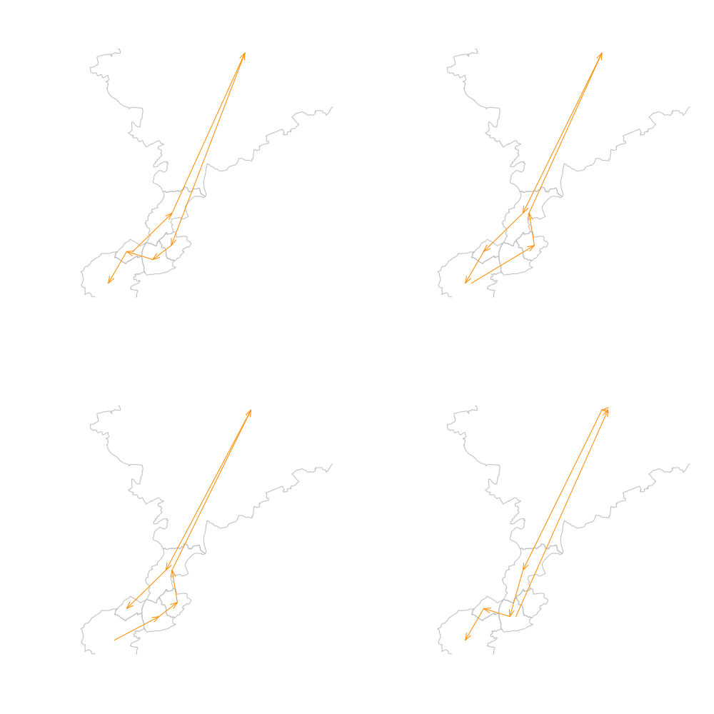
Lastly, there is a control that allows for limiting the Maximum Rank of Hosts and Maximum Rank of Guests. This control is essential for focusing on the most relevant commutes, as origin-destination analyses often involve numerous interactions that can make the situation unclear. By setting a limit, we can visualize and sort the hosts and guests by their nominal values in decreasing order in a pie chart. Information about the impact of this reduction is available in the narrative. During evaluation in the narrative, we sum up all the qualified items for the entire period and calculate the percentage they represent from the total.
Now, how does the ranking computation work? To simplify the visualization, we rank the hosts (for Guest View) and guests (for Host View) from high to low, and include an item in the statistics if it reaches the rank set by the maximum. This means that the number of items listed in the pie chart may not necessarily correspond to the maximum rank. In fact, it is quite common for them not to, as the first six hosts (guests) for a given guest (host) may change over the course of months, specifically average weekdays in a month. This situation might be easily visible in the spider chart, where not all possible positions weekday in month, host (guest) are filled.
LIST: Guests and Hosts Combinations by Weekdays
Guests and Hosts Combinations by Weekdays list is independent in terms of controls settings.
On this list you may combine multiple relations of Hosts and Guests and see Value (Number of Population, i.e. Number of Commutes) and Traveled Distance (km). Traveled Distance is the distance of Location a (origin) and Location b (destination) centroids multiplied by Number of Commutes. Nominal and change from the base line visuals are available.
There is an additional variable called commutes_census. See next.
LIST: Check Against Census 2021
This list enables compare of morning_commutes and commutes_census for particular weekday by Select Weekday in Month control. The control applies to all visuals except of the one showing entire timeline available. See Czech Statistical Office Data Integration for details.
LIST: Dataset Statistics
Finally, there is a list with overall statistics of the dataset.
VERTEX ATTRIBUTE WEEKDAYS
The VERTEX ATTRIBUTE WEEKDAYS dataset will help you to answer following questions about population mobility in Czechia.
- How do multiple indicators trends and values in a single location look like?
- How does the single indicator compare in multiple locations?
- How do data from different providers reflect COVID-19 pandemic progression?
- How does ATLAS 2023 compare with other data which have a certain degree of common semantic similarity?
- How does the change in the average population in the morning compare to the usual population in the winter and summer months?
- What are differences of population change across regions?
- How does the range (maximum - minimum) of the population in the morning compare to the average population in the morning?
- What is the population balance in a single location within a daily cycle?
In an addition following questions can be addressed based on an ad hoc model outputs.
- Which locations have an aerial way and can be considered ski resorts?
- How do locations classified as ski resorts compare in terms of population during the peak season?

General Concepts
There is several lists available in the session VERTEX ATTRIBUTE WEEKDAYS which present Variables predicted by VSB-TUO1, Variables reported by GOOGLE2 and Variables reported by the GOVERNMENT3,4.
Variables predicted by VSB-TUO1
These variables have prefix vsb and suffix values_nominal or change_from_baseline.
non_commuting_populationpopulation_in_morningcommutes_from_locationcommutes_to_locationcommutes_in_location
Variables reported by GOOGLE2
These variables have prefix google and suffix change_from_baseline. We select only those variables provided by GOOGLE that exhibit a certain degree of common semantic similarity with the Atlas 2023 data.
mobility_retail_and_recreationmobility_workplacesmobility_residential
Variables reported by the GOVERNMENT3,4
These variables have prefix gov and suffix values_nominal. In case o,OVID data reference_nominal is used as suffix instead of value_nominal for technical reasons related to the database structure.
Official statistics about COVID-19 development.
covid_new_casescovid_active_cases
Expected usual population presented by the Czech Statistical Office. The number of inhabitants of the municipality as of 31.12. (item 60021,POCOBY_OBEC) from RSO5. All data refer to all residents who have a permanent residence in the Czech Republic, regardless of citizenship. The data also includes foreigners with visas longer than 90 days, foreigners with granted asylum, citizens of EU countries with temporary residence in the territory of the Czech Republic and citizens of third countries with long-term residence. On the basis of statistical reports on births and deaths and files of migration, the Czech Statistical Office prepares an annual balance of the population of the Czech Republic for all municipalities following the results of the last census. All four military districts with zero population are also listed in the publication. We consider it necessary to draw attention to possible objectively necessary deviations of the indicated numbers of inhabitants from the records of municipal and city authorities. The Czech Statistical Office does not have records of residents and the processing of the balance is based on documents other than the records of residents kept pursuant to Act No. 133/2000 Coll. on registration of residents and birth numbers as amended. The information was downloaded once from iRSO5 on 2019-03-10. At that time, the register under the item Number of inhabitants of the municipality as of 31.12. contained data as of 2018-01-01. These numbers are listed in the database. It is possible to check through the archives of the Czech Statistical Office. Počet obyvatel v obcích.
population_usual_2019
Controls in Lists
-
Select Spatial Levelis common to all lists. -
Lists where the single location can be inspected, ie.
Indicators in Location,CovidandMobility Trendshave common controlsSelect Location. Change of these in any of two sheets will promote through them. ListsIndicators in LocationandMobility TrendsenableSelect Weekdays. -
The list
Locations by Indicatorwhich enables to compare multiple locations is independent of other lists in terms of settings, except ofSelect Spatial Level.
LIST: Indicators in Location
The list allows you to compare multiple indicators for a single location. You can focus on weekdays and narrow the search to a specific month. For example, an interesting approach is to observe the differences on weekends during the summer vacation period in July and August.
LIST: Locations by Indicator
Locations have different population mobility characteristics. The purpose of the list is to compare indicators in locations.
LIST: Covid
In this view we may see values of dataset COVID-19: Epidemiologická charakteristika obcí 3 active cases, selected values of dataset Community Mobility Reports2 and selected values of Atlas 20231.
Indicators are expressed as the change from baseline. The covid_active_cases variable has 0 baseline, so these values are synchronized in visuals on the secondary y axis.
LIST: Mobility Trends
When predicting data for Atlas 2023, we ensured that the trends correlated with an independent, alternative approach. The Community Mobility Reports2 provided a certain degree of common semantics. The results of these two methods, along with vendor datasets, are presented in this list.
LIST: Seasons
The list is independent in terms of controls, providing a different data view compared to other lists, except of the Spatial Level which is the common control with the list Ranges. It displays all locations belonging to the same spatial level together. The controls allow users to select either winter or summer months and observe the differences between the usual population and the estimated population on Wednesdays (considered typical working days) and Sundays (typical free days in the country).
LIST: Ranges
The list displays all locations belonging to the same spatial level together for the entire period, enabling the identification of locations that experience the highest and lowest levels of volatility in demand for infrastructure and services capacity due to changes in the present population.
LIST: Dataset Statistics
Overall statistics of the dataset.
LIST: Dataset Overview
The list summarizes Atlas 2023 core results are the Spatial Level of the state, the Czech Republic.
Definitions
Edge Commute Dataset
Commutes
Commutes. The commutes represent the most significant destinations during the daily cycle and the return from these destinations. The model does not attempt to identify the specific type of activity, nor does it distinguish the socio-economic purpose of the commutes. The value is estimate of VSB-TUO. The minimalSpatial Levelprocessed in predictive model isLocal Residential Unit. From this level aggregates of a higher spatial levels are generated. See also Czech Statistical Office Data Integration.
Morning commutes
Morning commutes. Commutes to the most significant destinations during the daily cycle. The model does not attempt to identify the specific type of activity, nor does it distinguish the socio-economic purpose of the commutes. The value is estimate of VSB-TUO. See also Czech Statistical Office Data Integration.
Evening commutes
Evening commutes. Commutes from the most significant destinations during the daily cycle. The model does not attempt to identify the specific type of activity, nor does it distinguish the socio-economic purpose of the commutes. The value is estimate of VSB-TUO. See also Czech Statistical Office Data Integration.
Commuting to work or school between municipalities (Commutes census)
Commutes census. Individuals traveling/commuting to work and school are employees (workers) or pupils and students whose workplace or school address is different from their usual place of residence. The group of commuters does not include individuals working/studying at their usual place of residence, people employed without a fixed workplace, and individuals with an unspecified workplace/school location. The question regarding the workplace/school location was only filled out by employees (workers) and pupils and students. Pupils and students who also work while studying provided the address of their workplace. The workplace address referred to the location where work is performed (not, for example, the company's headquarters). Individuals who did not have a fixed workplace but started their work hours at the same address (e.g., transport workers - drivers, etc.) indicated the place of employment. Individuals who frequently change their workplace location statedemployment without a fixed workplace. Values of 2021 census which was conducted between 27. 3. and 11. 5. are used. The minimalSpatial Levelreported in census results isMunicipality. From this level aggregates of a higher spatial levels are generated. The value is reported by Czech Statistical Office. See Commuting to work or school between municipalities for details.
Vertex Attribute Dataset
Population in morning
Population in morning. Estimated population in the morning. The value is estimate of VSB-TUO. We predict unique population that is present in theLocationin time between 00:00:00 and 04:59:59.
Commutes from location
Commutes from location. This represents the number of people commuting from the given location, where they reside between 00:00:00 and 04:59:59, to any commuting destination (typically work or school, generally the destination where they spend the longest time in the daily cycle) situated outside of the location. The location is a polygon defined by the Location code. The value is estimate of VSB-TUO. See also Czech Statistical Office Data Integration.
Commutes to location
Commutes to location. This indicates the number of people commuting to the given location (typically work or school, generally the destination where they spend the longest time in the daily cycle) from any commuting origin where they reside between 00:00:00 and 04:59:59 and which is situated outside of the location. The location is a polygon defined by the Location code. The value is estimate of VSB-TUO. See also Czech Statistical Office Data Integration.
Commutes in location
Commutes in location. This refers to the number of people commuting from the given location where they reside between 00:00:00 and 04:59:59 to any commuting destination (typically work or school, generally the destination where they spend the longest time in the daily cycle), or the other way around within the location. The location is a polygon defined by the Location code. The commute within a location is considered as soon as the border of the smallest computation node within that location, the Local residential unit, is crossed. The value is estimate of VSB-TUO. See also Czech Statistical Office Data Integration.
Non-commuting population
Non-commuting population. These individuals do not cross during the daily cycle the minimal radii that depend on the specifics of the location. The average limits for individual types of radii are as follows: Dense-urban 300 meters, urban 600 meters, suburban 1300 meters, rural 2800 meters. The value is estimate of VSB-TUO.
Other
Husbandmen
Husbandmen. If the condition of the place of occurrence in the morning and evening time windows is met, the sim is classified as husbandman, homesteader (a person who cultivates the land; a farmer. In more general someone who spends their entire lives within sight of their homes.) . We use the term in the connotation of a daily cycle. The exact semantics of the meaning of the word indicates a longer period of time. Semantics Husbandman.
Nomad
Nomad. If the condition of matching the place of occurrence in the morning and evening time window is not met, the classification nomad / nomad (a member of a people having no permanent abode, and who travel from place to place to find fresh pasture for their livestock.) is used. We use the term in the connotation of a daily cycle. The exact semantics of the meaning of the word indicates a longer period of time when used for the population. The term is also used in telecommunications terminology, in connection with the localization of a telecommunications service, where it stands between a telecommunications service provided in a fixed location and a fully mobile service (mobile network). Semantics Nomad.
Commutes
Commutes.


The single commute of an individual from C to A. MORNING – DAY. RED. The single commute of the same individual from A to C. DAY – EVENING. BLUE. Return to the starting point (in daily cycle).


Commutes of two people from C to A. MORNING – DAY. RED. The single commute of one person from A to B and other single commute of a second person from A to D. DAY – EVENING. BLUE.


Valid situation for the nomadic commuter attribute. In the MORNING – DAY window staying in the place, and the commute is executed in DAY – EVENING relation. This causes an inballance between the number of MORNING – DAY and DAY – EVENING commutes numbers visible in analytical tools.
Intensities
The load on the transportation model with the attribute Commutes or the attribute All to all commuting.

Implementation of the model for classifying SIM Commutes. I Stations of Significant Occurrence in Daily Cycle (Husbandman) or Station of Significant Occurrence in Morning Time Window (Nomad). N Station of Commutes in Daily Cycle. I-N attribute Commutes. A-C attribute Intensity between neighboring spatial units. I-F-E-A-C-D-N fastest route on the road network from I N.

Attribute A-C Intensity between neighboring spatial units is the sum of all SIMs Commutes for which station O has been determined as Station of Significant Occurrence in Daily Cycle or Station of Significant Occurrence in Morning Time Window and station N as Station of Commutes in Daily Cycle.

Attribute A-C Intensity between neighboring spatial units is the sum of paths that originate from relationships where the fastest connection on the road network passes through the segment A-C. The path N-D-C-G or G-C-D does not enter the calculation of attribute A-C in the edge model but enters the node model for vertex C.
All to all commuting
The relational matrices of the All to all commuting matrix cellular network intensity represent the links between pairs of places that occur in the daily cycle. In each of the 48 time windows in the daily cycle, there is exactly one single occurrence of the assumed user. The change of location can be determined with a threshold of a defined number of minutes at the location.
Spatial Levels in the Czech Republic
View in Geoprohlížeč: ATLAS MOBILITY DISTRICT COUNTIES (platnost do Sep 21, 2024).
Table: Spatial Levels in the Czech Republic6
| Spatial Granurality Code List | Spatial Granurality Abbreviation CS | Spatial Granurality Name EN | Spatial Granurality Name CS |
|---|---|---|---|
| cis0097 | sta | State | Stát |
| cis0100 | kra | Regions | Kraje |
| cis0101 | okr | District counties | Okresy |
| cis0065 | orp | Governing municipalities | Správní obvody obcí s rozšířenou působností |
| cis0044 | mco | Municipality districts | Městské části |
| cis0043 | obe | Municipalities | Obce a vojenské újezdy |
| cis0051 | zuj | Basic territorial units | Základní územní jednotky |
| cis0047 | zsj | Local residential units | Základní sídelní jednotky |
Spatial Levels in the Czech Republic Basic Indicators 2019
Table: Spatial Levels in the Czech Republic Basic Indicators 2019
| Spatial Granurality Code List CZSO | Spatial Granurality Name | Number of Locations | Usual population | Area (km2) | Average Distances of Locations´ Centroids | Average Area of Location (km2) | Average Population in Location |
|---|---|---|---|---|---|---|---|
| cis0097 | State | 1 | 10,610,055 | 78,874 | 280.85 | 78,874.0 | 10,610,055 |
| cis0044 | Municipality districts | 142 | 2,479,800 | 1,453 | 3.20 | 10.2 | 17,463 |
| cis0065 | Governing municipalities | 206 | 10,610,055 | 78,874 | 19.57 | 382.9 | 51,505 |
| cis0101 | District counties | 77 | 10,610,055 | 78,874 | 32.01 | 1,024.3 | 137,793 |
| cis0043 | Municipalities | 6,258 | 10,610,055 | 78,874 | 3.55 | 12.6 | 1,695 |
| cis0051 | Basic territorial units | 6,392 | 10,610,055 | 78,874 | 3.51 | 12.3 | 1,660 |
| cis0047 | Local residential units | 22,598 | 10,610,055 | 78,874 | 1.87 | 3.5 | 470 |
| cis0100 | Regions | 14 | 10,610,055 | 78,874 | 75.06 | 5,633.9 | 757,861 |
| cis4141 | Smart territories | 27,746 | 10,610,055 | 78,874 | 1.69 | 2.8 | 382 |
Names of Locations
Before brackets the full names of locations are provided in the Select Location or Select Locations controls. Inside of brackets there is an additional information about the location. This is provide to enable navigation with codes used by iRSO5 and also to define the location uniquely. Some locations might have the same name, thus representing a different spatial entities. By way of an example Jablonec nad Nisou (40533) is the District County, Jablonec nad Nisou (orp JabNNis - 563510) is the municipality.
The meaning of suffixes to names is following, depending on the Spatial Level.
- Regions:
Hlavní město Praha (3018).<location name> (<code of the location>). - District Counties:
Hlavní město Praha (40924).<location name> (<code of the location>). - Municipalities:
Jablonec nad Nisou (orp JabNNis - 563510).<location name> (orp <abbreviated name of governing municipality for the location> - <code of the location>). In this case,p"stays forSprávní obvody obcí s rozšířenou působností~Governing municipalities.
See Spatial Levels in the Czech Republic.
Average Weekday
To identify time, we use a non-standard label that may not be familiar to all readers. Instead of using a typical unit of time (such as days, weeks, or months), the x-axis of each graph represents the average value for a typical weekday in a given month, based on available data. For instance, the label 2019101 indicates the average value for Mondays in October 2019. This visualization technique was recommended by projects results as it provides a more comprehensive overview of the data over time and reduces the impact of data unavailability on specific days, while maintaining the accuracy of the data.
-
Atlas of population mobility in czechia. June 2023. Accessed on June 30, 2023. URL: https://danse.tech/atlas/results/. ↩↩↩
-
Community mobility reports. 2020. Accessed on November 1, 2022. URL: https://www.google.com/covid19/mobility/. ↩↩↩↩
-
Covid-19: epidemiologická charakteristika obcí. 2020. Accessed on April 1, 2023. URL: https://onemocneni-aktualne.mzcr.cz/api/v2/covid-19. ↩↩↩
-
Počet obyvatel v obcích - k 1.1.2018. 3 2019. Accessed on June 30, 2023. URL: https://www.czso.cz/csu/czso/pocet-obyvatel-v-obcich-see2a5tx8j. ↩↩
-
Registr sčítacích obvodů a budov. 3 2019. Accessed on March 10, 2019. URL: https://apl.czso.cz/irso4/home.jsp. ↩↩↩
-
Territorial structure. 2 2023. Accessed on February 28, 2023. URL: https://www.czso.cz/csu/rso/territorial-structure. ↩